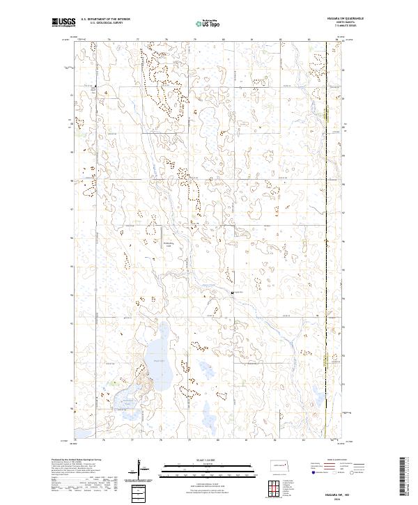
2024 Map of Niagara SW
USGS Topo · Published 2024About this map
Nelson County Waterfowl Production Area dominates this section of the prairie pothole region, where the landscape is defined by countless small wetlands and seasonal basins. This contemporary survey of eastern Nelson County shows a complex drainage network where Goose Creek winds through a high density of water bodies, including Rugh Lake and Horseshoe Lake. The rural character of the area is maintained through a strictly orthogonal road grid, with local routes like Co Rd 18 and 121st Ave NE providing access to isolated landmarks. Notable local heritage sites include Adler Union Cem in the northwest and Logan Cem further south, both serving as markers of the area's early homesteading history. The presence of Ricketyback Field indicates modern agricultural use alongside conservation efforts.
Find a feature on this map
34 named features on this map. Tap any name to fly to it.
Don’t see what you’re looking for? This feature index may not catch every label — zoom into the map to look around manually.
Map Details
Editions of this 2024 Niagara SW Map
This is the sole edition of this map. No revisions or reprints were ever made.
Other maps of this area

1939 · Niagara
USGS Topo · 1:62,500

1942 · McVille
USGS Topo · 1:62,500

1952 · Grand Forks
USGS Topo · 1:250,000

1952 · New Rockford
USGS Topo · 1:250,000

1956 · New Rockford
USGS Topo · 1:250,000

1956 · Grand Forks
USGS Topo · 1:250,000

1963 · Niagara SW
USGS Topo · 1:24,000
1963 · McVille SE
USGS Topo · 1:24,000
1963 · Niagara
USGS Topo · 1:24,000

1963 · Logan Center
USGS Topo · 1:24,000