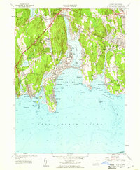
1958 Map of Niantic
USGS Topo · Published 1959About this map
Niantic Bay and the Niantic River anchor this coastal landscape, where the seasonal character of the Connecticut shore is evident in the cluster of beach communities like Attawan Beach, Crescent Park, and the Black Point Beach Club. The era's transportation infrastructure is transitioning, shown by the Blue Star Memorial Highway and the Connecticut Turnpike cutting through the northern reaches near Flanders. This survey captures the region's diverse mid-century land use, from the State Military Camp and State Farm for Women to industrial operations at the Millstone Quarry. Traditional New England town life is grounded in the presence of local landmarks like the Stone Church, Jordan Cem, and the State Sanitarium near Seaside. Along the shoreline, prominent features such as McCook Point and Millstone Point define the rocky coast before it drops away into Long Island Sound.
Find a feature on this map
118 named features on this map. Tap any name to fly to it.
Don’t see what you’re looking for? This feature index may not catch every label — zoom into the map to look around manually.
Map Details
Editions of this 1958 Niantic Map
3 editions found
Other maps of this area

1892 · New London
USGS Topo · 1:62,500

1893 · New London
USGS Topo · 1:62,500

1893 · Saybrook
USGS Topo · 1:62,500

1903 · Gardiners Island
USGS Topo · 1:62,500

1904 · Gardiners Island
USGS Topo · 1:62,500

1921 · Gardiners Island
USGS Topo · 1:62,500

1921 · New London
USGS Topo · 1:62,500

1934 · Niantic
USGS Topo · 1:24,000

1935 · Montville
USGS Topo · 1:24,000

1938 · New London
USGS Topo · 1:31,680