
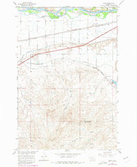
1967 Map of Nibbe
USGS Topo · Published 1971About this map
The Yellowstone River cuts across the northern edge of this Montana landscape, where the historic Lewis and Clark Trail follows the river valley near the landmark Pompeys Pillar. By the late 1960s, the region’s agricultural infrastructure is well-defined by the Huntley Main Canal and Highline Canal, which navigate the elevation changes between the fertile valley floor and the rising southern bluffs. Small siding settlements and shipping points like Nibbe, Newton, and Mann line the Northern Pacific railroad tracks, while the Chicago Burlington and Quincy line skirts the edges of Anita Reservoir. To the south, the terrain transforms into a complex network of drainages such as Barley Coulee, illustrating the transition from irrigated riverfront to the open, dissected uplands along the Yellowstone and Big Horn County line.
Find a feature on this map
22 named features on this map. Tap any name to fly to it.
Don’t see what you’re looking for? This feature index may not catch every label — zoom into the map to look around manually.
Map Details
Editions of this 1967 Nibbe Map
2 editions found
Other maps of this area

1893 · Huntley
USGS Topo · 1:125,000

1894 · Fort Custer
USGS Topo · 1:125,000

1954 · Billings
USGS Topo · 1:250,000

1954 · Hardin
USGS Topo · 1:250,000

1954 · Forsyth
USGS Topo · 1:250,000

1954 · Roundup
USGS Topo · 1:250,000

1957 · Hardin
USGS Topo · 1:250,000

1957 · Forsyth
USGS Topo · 1:250,000

1957 · Billings
USGS Topo · 1:250,000

1958 · Billings
USGS Topo · 1:250,000