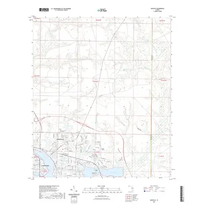
2021 Map of Niceville
USGS Topo · Published 2021About this map
Niceville and Valparaiso anchor this coastal landscape where urban street grids meet the intricate fingers of the Choctawhatchee Bay drainage system. The map reveals a community defined by its water, from the expansive Rocky Bayou and Toms Bayou to smaller interior basins like Plew Lake and Roberts Lake. A dense network of named residential streets, such as Roscommon Blvd and Valparaiso Blvd, surrounds established local landmarks like the Northwest Florida State College campus and Ruckel Airport. Along the eastern edges of the bayous, family and community history is preserved at Early Cem and Rocky Cem. The importance of modern infrastructure is evident at the C G Meigs Bridge, which facilitates movement across the bayou systems that otherwise isolate various peninsulas and points like Nelson Point. Numerous named branches, including Sarah Ann Br and Shaw-Stik Br, drain the upland terrain into the bayous.
Find a feature on this map
116 named features on this map. Tap any name to fly to it.
Don’t see what you’re looking for? This feature index may not catch every label — zoom into the map to look around manually.
Map Details
Editions of this 2021 Niceville Map
This is the sole edition of this map. No revisions or reprints were ever made.
Other maps of this area

1934 · Holt
USGS Topo · 1:48,000

1934 · Niceville
USGS Topo · 1:48,000

1935 · Villa Tasso
USGS Topo · 1:48,000

1936 · Niceville
USGS Topo · 1:62,500

1937 · Holt
USGS Topo · 1:62,500

1938 · Mary Esther
USGS Topo · 1:62,500

1938 · Villa Tasso
USGS Topo · 1:62,500

1956 · Niceville
USGS Topo · 1:62,500

1956 · Fort Walton Beach
USGS Topo · 1:62,500

1956 · Holt
USGS Topo · 1:62,500