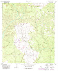
1970 Map of Niceville SE
USGS Topo · Published 1988About this map
Eglin Air Force Base dominates this landscape in Walton County, revealing the intersection of military infrastructure and the Florida panhandle's dense hydrological network. Photogrammetric methods from 1969 show a territory carved by a multitude of head branches and creeks, such as Rocky Creek and Mullet Creek, which flow toward the southern coastal basins. The map documents specialized utility in the land, from a central Landing Strip and numerous firebreaks to the industrial activity at several sandpits. For those tracing local heritage, the map identifies specific landmarks like Black Oak Cem and another Cemetery near the southern boundary, along with several towers and a Lookout Tower used for monitoring this wooded terrain. The nomenclature of the waterways, including Schoolhouse Branch and Yellow Root Br, suggests a deep-rooted connection to the local environment and its history of settlement and resource use.
Find a feature on this map
40 named features on this map. Tap any name to fly to it.
Don’t see what you’re looking for? This feature index may not catch every label — zoom into the map to look around manually.
Map Details
Editions of this 1970 Niceville SE Map
3 editions found
Other maps of this area

1934 · Niceville
USGS Topo · 1:48,000

1935 · Villa Tasso
USGS Topo · 1:48,000

1935 · De Funiak Springs
USGS Topo · 1:48,000

1936 · Niceville
USGS Topo · 1:62,500

1936 · Point Washington
USGS Topo · 1:48,000

1938 · Villa Tasso
USGS Topo · 1:62,500

1938 · De Funiak Springs
USGS Topo · 1:62,500

1939 · Point Washington
USGS Topo · 1:62,500

1956 · Niceville
USGS Topo · 1:62,500

1956 · Villa Tasso
USGS Topo · 1:62,500