1956 Map of Niceville
USGS Topo · Published 1958About this map
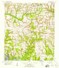
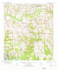
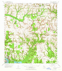
Eglin Air Force Base dominates the central landscape of this mid-century Florida survey, showing a massive military footprint characterized by specialized landing strips like Wagner Field, Baldsiefen Field, and Pierce Field. The settlement pattern is concentrated in the southwest near the coastal waters of Rocky Bayou, where the growing towns of Niceville and Valparaiso sit adjacent to Nelson Point. This era reflects a transition between traditional Gulf Coast life and the rapid expansion of federal defense infrastructure.
Find a feature on this map
82 named features on this map. Tap any name to fly to it.
Don’t see what you’re looking for? This feature index may not catch every label — zoom into the map to look around manually.
Map Details
Editions of this 1956 Niceville Map
3 editions found
Other maps of this area

1934 · Holt
USGS Topo · 1:48,000

1934 · Niceville
USGS Topo · 1:48,000

1935 · Villa Tasso
USGS Topo · 1:48,000

1935 · De Funiak Springs
USGS Topo · 1:48,000

1936 · Niceville
USGS Topo · 1:62,500

1936 · Point Washington
USGS Topo · 1:48,000

1937 · Holt
USGS Topo · 1:62,500

1938 · Mary Esther
USGS Topo · 1:62,500

1938 · Villa Tasso
USGS Topo · 1:62,500

1938 · De Funiak Springs
USGS Topo · 1:62,500