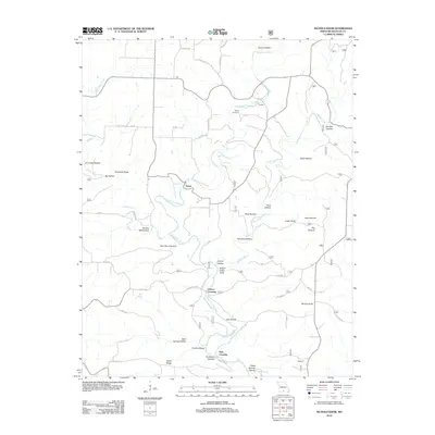
2012 Map of Nichols Knob
USGS Topo · Published 2012About this map
The North Fork River carves a winding path through this portion of Douglas County, defining a landscape of high ridges and named hollows. Small communities and river crossings like Topaz, Florilla, and Osborn Crossing serve as central points in a network of rural roads such as State Hwy E and Co Rd 181-288. The map documents numerous family-named or descriptive terrain features, including Brushy Mill Hollow, Toothpick Ridge, and Nichols Knob. These names often reflect early pioneer settlement patterns and the local geography of the Missouri Ozarks. Natural water sources are prominent throughout the area, with several named springs such as Hoots Spring, Mint Spring, and Fiddle Springs located near the river and its tributaries like Indian Creek and Clifty Creek. For those tracing family history, the Bittick Cemetery is a notable landmark situated north of the river.
Find a feature on this map
61 named features on this map. Tap any name to fly to it.
Don’t see what you’re looking for? This feature index may not catch every label — zoom into the map to look around manually.
Map Details
Editions of this 2012 Nichols Knob Map
This is the sole edition of this map. No revisions or reprints were ever made.
Other maps of this area

1937 · Buckhart
USGS Topo · 1:48,000

1939 · Topaz
USGS Topo · 1:62,500

1941 · Topaz
USGS Topo · 1:62,500

1943 · Buckhart
USGS Topo · 1:62,500

1945 · Harrison
USGS Topo · 1:250,000

1945 · Buckhart
USGS Topo · 1:62,500

1949 · Harrison
USGS Topo · 1:250,000

1950 · Cabool SW
USGS Topo · 1:24,000

1951 · Mountain Grove South
USGS Topo · 1:24,000

1951 · Cabool SE
USGS Topo · 1:24,000