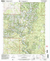
2004 Map of Nichols Knob
USGS Topo · Published 2006About this map
Topaz sits as a quiet focal point in this portion of the Mark Twain National Forest, where the North Fork River carves a winding path through a landscape defined by sharp ridges and deep hollows. The presence of Topaz Spring and the Osborn Crossing suggests a long-standing reliance on the river for travel and resources in the Douglas County backcountry. Local spiritual life is well-documented through scattered landmarks such as Pleasant Home Ch, Mount Ararat Ch, and the uniquely named Y Church.
Find a feature on this map
43 named features on this map. Tap any name to fly to it.
Don’t see what you’re looking for? This feature index may not catch every label — zoom into the map to look around manually.
Map Details
Editions of this 2004 Nichols Knob Map
This is the sole edition of this map. No revisions or reprints were ever made.
Other maps of this area

1937 · Buckhart
USGS Topo · 1:48,000

1939 · Topaz
USGS Topo · 1:62,500

1941 · Topaz
USGS Topo · 1:62,500

1943 · Buckhart
USGS Topo · 1:62,500

1945 · Harrison
USGS Topo · 1:250,000

1945 · Buckhart
USGS Topo · 1:62,500

1949 · Harrison
USGS Topo · 1:250,000

1950 · Cabool SW
USGS Topo · 1:24,000

1951 · Mountain Grove South
USGS Topo · 1:24,000

1951 · Cabool SE
USGS Topo · 1:24,000