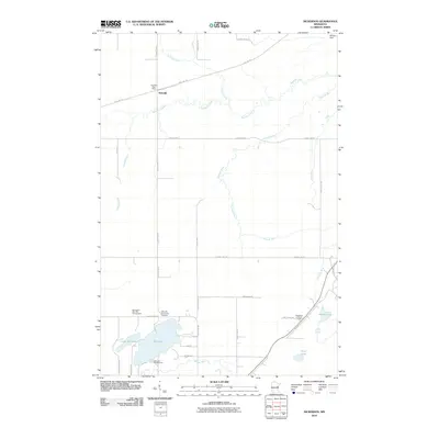
2010 Map of Nickerson
USGS Topo · Published 2010About this map
Nemadji serves as a primary settlement point in this northern landscape, where the Nemadji Post Office sits along the Soo Line Trl. The terrain is defined by the winding course of the Nemadji River and its numerous tributaries, including Hunters Creek and Clear Creek. This 2010 survey highlights a transition from the river-fed lowlands to a lake-dotted southern region. Recreational and community landmarks are concentrated around Oak Lake, which is flanked by the Oak Lake Campground and the Oak Lake Community Cemetery. Further east, the Nickerson Lookout Tower stands as a prominent marker on the higher ground near Old Hwy 23. The road network, including County Hwy-11 and County Hwy-8, reflects the area's rural development and the preservation of its natural waterways.
Find a feature on this map
37 named features on this map. Tap any name to fly to it.
Don’t see what you’re looking for? This feature index may not catch every label — zoom into the map to look around manually.
Map Details
Editions of this 2010 Nickerson Map
This is the sole edition of this map. No revisions or reprints were ever made.
Other maps of this area

1949 · Holyoke
USGS Topo · 1:48,000

1953 · Duluth
USGS Topo · 1:250,000

1954 · Wrenshall
USGS Topo · 1:24,000

1954 · Atkinson
USGS Topo · 1:24,000

1956 · Barnum
USGS Topo · 1:62,500

1958 · Duluth
USGS Topo · 1:250,000

1962 · Holyoke
USGS Topo · 1:62,500

1962 · Bruno
USGS Topo · 1:62,500

1980 · Sandstone
USGS Topo · 1:100,000

1980 · Duluth
USGS Topo · 1:100,000