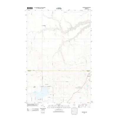
2013 Map of Nickerson
USGS Topo · Published 2013About this map
The Nemadji River and its intricate drainage network, including Hunters Cr and Nemadji Cr, carve through the glacial landscape along the border of Carlton and Pine Counties. This northern Minnesota terrain is defined by a series of lakes and wetlands, most notably Oak Lake, Little Oak Lake, and Wolf Lake. Settlement is concentrated around the small community of Nickerson in the southeast and the riverside location of Nemadji to the northwest.
Find a feature on this map
40 named features on this map. Tap any name to fly to it.
Don’t see what you’re looking for? This feature index may not catch every label — zoom into the map to look around manually.
Map Details
Editions of this 2013 Nickerson Map
This is the sole edition of this map. No revisions or reprints were ever made.
Other maps of this area

1949 · Holyoke
USGS Topo · 1:48,000

1953 · Duluth
USGS Topo · 1:250,000

1954 · Wrenshall
USGS Topo · 1:24,000

1954 · Atkinson
USGS Topo · 1:24,000

1956 · Barnum
USGS Topo · 1:62,500

1958 · Duluth
USGS Topo · 1:250,000

1962 · Holyoke
USGS Topo · 1:62,500

1962 · Bruno
USGS Topo · 1:62,500

1980 · Sandstone
USGS Topo · 1:100,000

1980 · Duluth
USGS Topo · 1:100,000