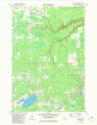
1981 Map of Nickerson
USGS Topo · Published 1982About this map
The boundary between Carlton and Pine counties divides this landscape, where the Burlington Northern railroad corridor and local waterways define the region's geography. The town of Nickerson serves as a local focal point near the intersection of various transit routes, including a prominent Lookout Tower positioned for forest monitoring. Much of the northern terrain is dedicated to the Dye State Wildlife Management Area, characterized by the winding paths of the Nemadji River and Hunters Creek.
Find a feature on this map
28 named features on this map. Tap any name to fly to it.
Don’t see what you’re looking for? This feature index may not catch every label — zoom into the map to look around manually.
Map Details
Editions of this 1981 Nickerson Map
This is the sole edition of this map. No revisions or reprints were ever made.
Other maps of this area

1949 · Holyoke
USGS Topo · 1:48,000

1953 · Duluth
USGS Topo · 1:250,000

1954 · Wrenshall
USGS Topo · 1:24,000

1954 · Atkinson
USGS Topo · 1:24,000

1956 · Barnum
USGS Topo · 1:62,500

1958 · Duluth
USGS Topo · 1:250,000

1962 · Holyoke
USGS Topo · 1:62,500

1962 · Bruno
USGS Topo · 1:62,500

1980 · Sandstone
USGS Topo · 1:100,000

1980 · Duluth
USGS Topo · 1:100,000