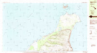
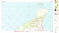
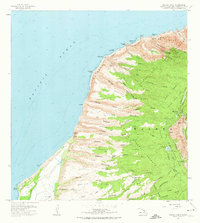
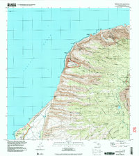
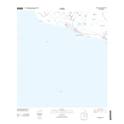
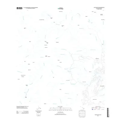
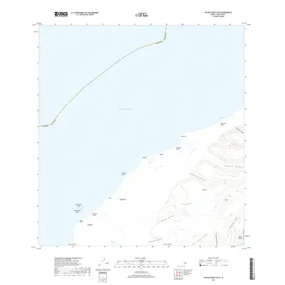
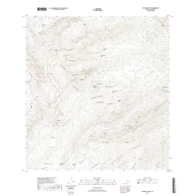
1984 Map of Niihau North
USGS Topo · Published 1984About this map
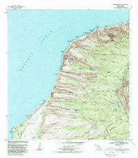
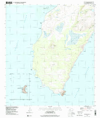
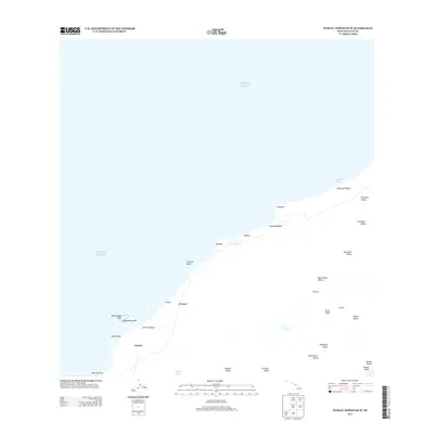
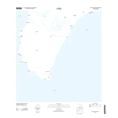
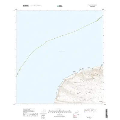
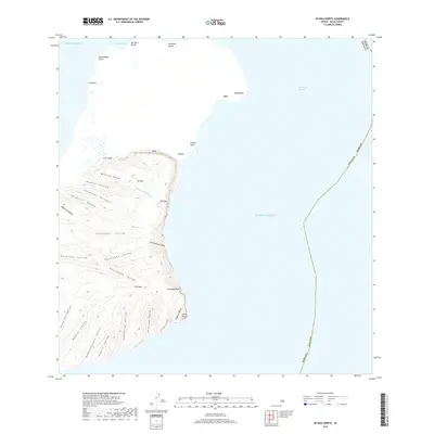
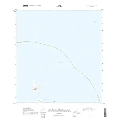
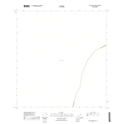
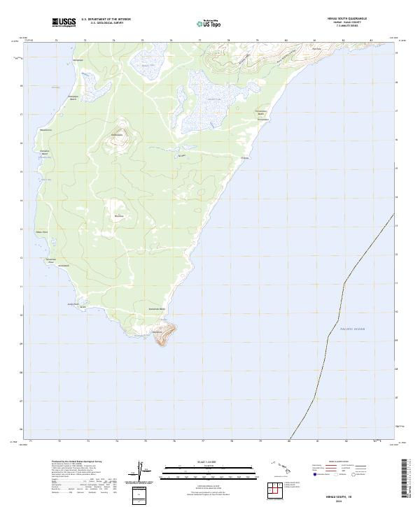
The northern reaches of Niihau, within the Waimea District, are characterized by a rugged volcanic landscape and the vital presence of water sources in an arid environment. The settlement of Puuwai sits on the western coast, connected to the interior by a series of trails and a prominent fence line that bisects the island's midsection. High points like Paniau and Kaali rise above numerous steep-walled valleys, including Mokoula Valley and Keanauhi Valley, which drain toward the coast. Off the northern tip, across the Lehua Channel, lies the crescent-shaped island of Lehua, home to the Lehua State Seabird Sanctuary. This map highlights the isolated infrastructure of the island in the mid-1980s, featuring landmarks such as a Ham Radio Tower and water management features like Loe Lake, Stock Pond, and Pal Well.
Find a feature on this map
38 named features on this map. Tap any name to fly to it.
Don’t see what you’re looking for? This feature index may not catch every label — zoom into the map to look around manually.
Map Details
Editions of this 1984 Niihau North Map
2 editions found
Historical Maps of Puuwai Through Time
51 maps found

1954 Kauai
Kauai County, HI
1965 Makaha Point
Kauai County, HI

1965 Waialeale
Kauai County, HI
1965 Waimea Canyon
Kauai County, HI

1967 Kauai
Kauai County, HI

1970 Kauai
Kauai County, HI
1983 Makaha Point
Kauai County, HI
1983 Waialeale
Kauai County, HI
1983 Waimea Canyon
Kauai County, HI
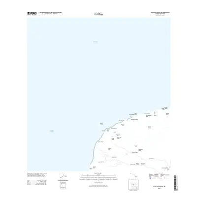
1984 Niihau North
Kauai County, HI
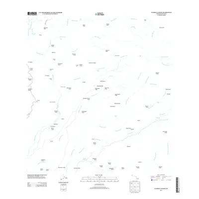
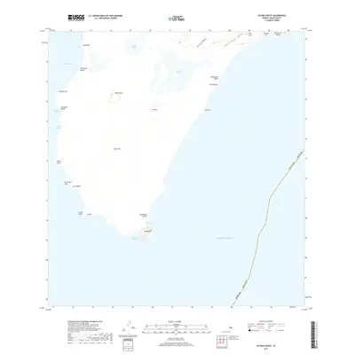
1984 Niihau South
Kauai County, HI
1989 Halalii Lake
Kauai County, HI
1989 Honuaula Valley
Kauai County, HI
1989 Kalanei
Kauai County, HI
1989 Keanauhi Valley
Kauai County, HI
1991 Makaha Point
Kauai County, HI
1991 Waialeale
Kauai County, HI
1991 Waimea Canyon
Kauai County, HI
2013 Kaula
Kauai County, HI
2013 Kekaha OE S
Kauai County, HI
2013 Makaha Point
Kauai County, HI
2013 Niihau North
Kauai County, HI
2013 Niihau North OE N
Kauai County, HI
2013 Niihau North OE NW
Kauai County, HI
2013 Niihau North OE W
Kauai County, HI
2013 Niihau South
Kauai County, HI
2013 Niihau South OE W
Kauai County, HI
2013 Waialeale
Kauai County, HI
2013 Waimea Canyon
Kauai County, HI
2017 Kaula
Kauai County, HI
2017 Kekaha OE S
Kauai County, HI
2017 Makaha Point
Kauai County, HI
2017 Niihau North
Kauai County, HI
2017 Niihau North OE N
Kauai County, HI
2017 Niihau North OE NW
Kauai County, HI
2017 Niihau North OE W
Kauai County, HI
2017 Niihau South
Kauai County, HI
2017 Niihau South OE W
Kauai County, HI
2017 Waialeale
Kauai County, HI
2017 Waimea Canyon
Kauai County, HI
2024 Kaula
Kauai County, HI
2024 Kekaha OE S
Kauai County, HI
2024 Makaha Point
Kauai County, HI
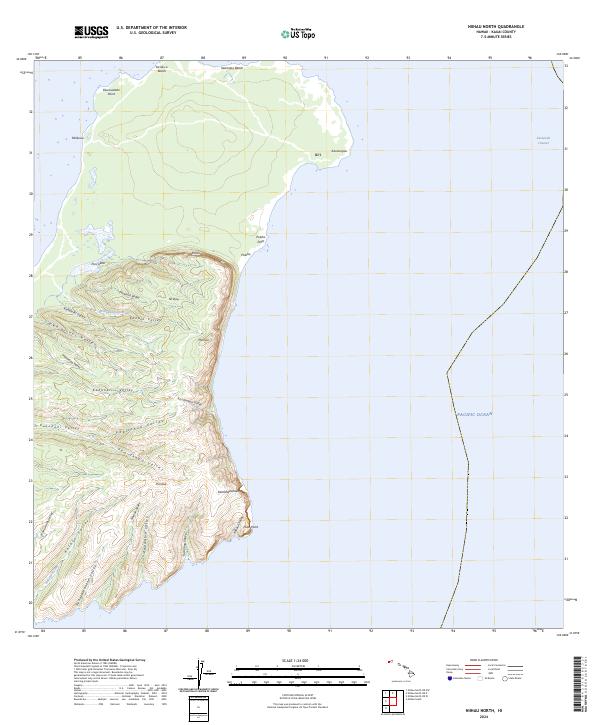
2024 Niihau North
Kauai County, HI
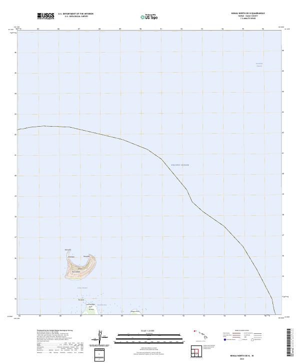
2024 Niihau North OE N
Kauai County, HI
2024 Niihau North OE NW
Kauai County, HI
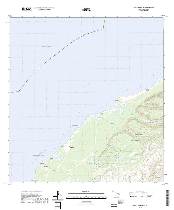
2024 Niihau North OE W
Kauai County, HI
2024 Niihau South
Kauai County, HI
2024 Niihau South OE W
Kauai County, HI
2024 Waialeale
Kauai County, HI
2024 Waimea Canyon
Kauai County, HI