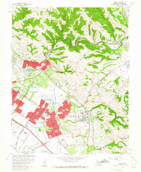
1961 Map of Niles
USGS Topo · Published 1961About this map
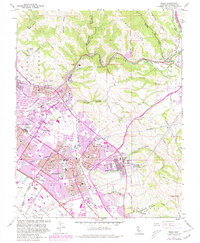
Alameda County terrain in the early 1960s reveals a transition from historic ranching and mission lands to modern suburban development within the newly incorporated Fremont. The landscape is anchored by the Mission San Jose District, where the Mission San Jose de Guadalupe and the Ohlones Cemetery stand near the base of Mission Peak. To the north, the Niles District and Niles Junction highlight the area's rail history, featuring the Southern Pacific and Western Pacific lines winding through Stonybrook Canyon and Niles Canyon Road.
Find a feature on this map
64 named features on this map. Tap any name to fly to it.
Don’t see what you’re looking for? This feature index may not catch every label — zoom into the map to look around manually.
Map Details
Editions of this 1961 Niles Map
6 editions found
Other maps of this area

1889 · San Jose
USGS Topo · 1:62,500

1897 · San Jose
USGS Topo · 1:62,500

1897 · Palo Alto
USGS Topo · 1:62,500

1899 · San Jose
USGS Topo · 1:62,500

1899 · Palo Alto
USGS Topo · 1:62,500

1899 · Haywards
USGS Topo · 1:62,500

1902 · Santa Cruz
USGS Topo · 1:125,000

1906 · Pleasanton
USGS Topo · 1:62,500

1915 · Haywards
USGS Topo · 1:62,500

1941 · Pleasanton
USGS Topo · 1:62,500