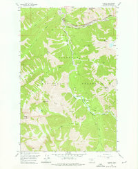
1958 Map of Nimrod
USGS Topo · Published 1976About this map
The Middle Fork Flathead River carves through the center of this terrain, serving as a natural boundary between Glacier National Park to the north and the Flathead National Forest to the south. The small settlement at Nimrod and the nearby Java Ranger Station represent the sparse human footprint in this wilderness during the mid-1950s. Transportation through the mountains is dominated by the Great Northern railroad line, which follows the river's course through John Stevens Canyon, and the Theodore Roosevelt Pass. High-altitude features like Spruce Lookout and Java Mountain overlook a network of pack trails that connect drainages such as Sheep Creek and Edna Creek. The presence of a Gaging Sta and Cable Crossing near Spruce Park highlights the ongoing hydrological monitoring of these critical mountain waters.
Find a feature on this map
34 named features on this map. Tap any name to fly to it.
Don’t see what you’re looking for? This feature index may not catch every label — zoom into the map to look around manually.
Map Details
Editions of this 1958 Nimrod Map
3 editions found
Other maps of this area

1913 · Marias Pass
USGS Topo · 1:125,000

1914 · Nyack
USGS Topo · 1:125,000

1958 · Circus Peak
USGS Topo · 1:24,000

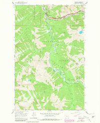
1958 · Nimrod
USGS Topo · 1:24,000

1958 · Quintonkon
USGS Topo · 1:24,000

1958 · Mount Bradley
USGS Topo · 1:24,000

1958 · Horseshoe Peak
USGS Topo · 1:24,000

1958 · Felix Peak
USGS Topo · 1:24,000

1960 · Cut Bank
USGS Topo · 1:250,000

1963 · Cut Bank
USGS Topo · 1:250,000