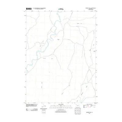
2010 Map of Ninemile Hill
USGS Topo · Published 2010About this map
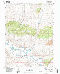
The Little Snake River meanders through the northwest corner of this Moffat County landscape, defining a series of sharp bends near Sellers Hole. This 2010 survey by the U.S. Geological Survey captures a sparsely populated region of northwestern Colorado, where the tiny settlement of Great Divide stands as a primary point of reference in the east. The terrain is marked by significant topographical shifts, from the broad expanse of Ninemile Basin to the prominent heights of Ninemile Hill and Bald Mountain. A network of unpaved thoroughfares, including County Rd-71 and County Rd-21, navigate the drainage patterns of Shaffers Draw and the Godiva Rim. The map provides a detailed look at the drainage basin for the West Fork Sand Creek, offering genealogists and land researchers a precise record of the county road infrastructure and geographic landmarks at the start of the decade.
Find a feature on this map
18 named features on this map. Tap any name to fly to it.
Don’t see what you’re looking for? This feature index may not catch every label — zoom into the map to look around manually.
Map Details
Editions of this 2010 Ninemile Hill Map
This is the sole edition of this map. No revisions or reprints were ever made.
Other maps of this area

1954 · Vernal
USGS Topo · 1:250,000

1958 · Vernal
USGS Topo · 1:250,000

1958 · Maybell
USGS Topo · 1:62,500

1960 · Vernal
USGS Topo · 1:250,000

1960 · Lone Mountain
USGS Topo · 1:62,500
1969 · The Nipple SE
USGS Topo · 1:24,000

1969 · The Nipple
USGS Topo · 1:24,000
1969 · Lang Spring
USGS Topo · 1:24,000
1979 · Canyon of Lodore
USGS Topo · 1:100,000
1986 · Maybell
USGS Topo · 1:24,000