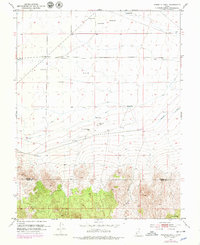
1953 Map of Ninemile Knoll
USGS Topo · Published 1979About this map
Ninemile Knoll serves as a central landmark in this arid basin where water management defines the landscape of the late 1970s. The survey reveals a complex network of resource extraction and water diversion, from the Irrigation Canal and various ditches to several Abandoned Wells and a Gravel Pit. The southern portion of the map transitions into the high terrain of Black Canyon, marking the boundary between Beaver Co and Iron Co. This area is characterized by seasonal or intermittent water features like Cactus Pond, Mound Pond, The Sink, and Dry Willow Spr, highlighting the importance of every localized spring and catchment for ranching or government use, as evidenced by the presence of a Windmill and Government Well.
Find a feature on this map
21 named features on this map. Tap any name to fly to it.
Don’t see what you’re looking for? This feature index may not catch every label — zoom into the map to look around manually.
Map Details
Editions of this 1953 Ninemile Knoll Map
2 editions found
Other maps of this area

1885 · Beaver
USGS Topo · 1:250,000

1953 · Ninemile Knoll
USGS Topo · 1:24,000

1953 · Milford Flat
USGS Topo · 1:24,000

1953 · Minersville
USGS Topo · 1:24,000

1953 · Cave Canyon
USGS Topo · 1:24,000

1953 · Richfield
USGS Topo · 1:250,000

1958 · Richfield
USGS Topo · 1:250,000

1958 · Minersville
USGS Topo · 1:62,500

1958 · Thermo
USGS Topo · 1:62,500

1958 · Milford
USGS Topo · 1:62,500