
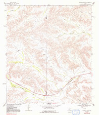
1968 Map of Ninemile Ranch
USGS Topo · Published 1971About this map
Sanderson Canyon and its associated waterway dominate the southern landscape of this West Texas region, carving a path through the arid terrain of Terrell County. This 1960s-era survey reveals a sparsely populated ranching environment where water management is central to survival, evidenced by scattered features like Fortyone Tank, Jackson Tank, and the Red Windmill Draw. The southern portion of the map follows the corridor of the Southern Pacific railroad, which runs parallel to the canyon and serves the small stop at Emerson.
Find a feature on this map
19 named features on this map. Tap any name to fly to it.
Don’t see what you’re looking for? This feature index may not catch every label — zoom into the map to look around manually.
Map Details
Editions of this 1968 Ninemile Ranch Map
2 editions found
Other maps of this area

1920 · Longfellow
USGS Topo · 1:125,000

1928 · Sanderson
USGS Topo · 1:125,000

1954 · Fort Stockton
USGS Topo · 1:250,000

1958 · Fort Stockton
USGS Topo · 1:250,000

1968 · Big Brindle Canyon
USGS Topo · 1:24,000

1968 · Toms Canyon
USGS Topo · 1:24,000

1968 · F C Ranch
USGS Topo · 1:24,000

1968 · Fresno Creek
USGS Topo · 1:24,000

1968 · Longfellow
USGS Topo · 1:24,000

1969 · Sanderson
USGS Topo · 1:24,000