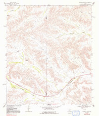
1968 Map of Ninemile Ranch
USGS Topo · Published 1992About this map
The Pecos Co Terrell Co line cuts through this high desert landscape, marking a territory defined by deep drainage draws and isolated water sources. Settlement is sparse, anchored by the Ninemile Ranch in the center of the sheet and the small outpost of Emerson to the southeast. Transport and commerce follow the low ground, with U.S. Highway 90 tracing the path of Sanderson Canyon and Dry Creek.
Find a feature on this map
17 named features on this map. Tap any name to fly to it.
Don’t see what you’re looking for? This feature index may not catch every label — zoom into the map to look around manually.
Map Details
Editions of this 1968 Ninemile Ranch Map
2 editions found
Other maps of this area

1920 · Longfellow
USGS Topo · 1:125,000

1928 · Sanderson
USGS Topo · 1:125,000

1954 · Fort Stockton
USGS Topo · 1:250,000

1958 · Fort Stockton
USGS Topo · 1:250,000

1968 · Big Brindle Canyon
USGS Topo · 1:24,000

1968 · Toms Canyon
USGS Topo · 1:24,000

1968 · F C Ranch
USGS Topo · 1:24,000

1968 · Fresno Creek
USGS Topo · 1:24,000

1968 · Longfellow
USGS Topo · 1:24,000

1968 · Ninemile Ranch
USGS Topo · 1:24,000