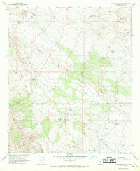
1966 Map of Ninetysix Hills NE
USGS Topo · Published 1969About this map
Box O Ranch and Helmchen Ranch anchor this landscape of the Ninetysix Hills during the mid-1960s, illustrating the ranching operations and water management systems required in this arid portion of Pinal County. The network of stock tanks, including Rock Tank, The Lake Tank, and Eight Section Tank, suggests a land use dedicated to livestock, connected by a primitive transportation grid of Jeep Trails and the Barkerville Road.
Find a feature on this map
24 named features on this map. Tap any name to fly to it.
Don’t see what you’re looking for? This feature index may not catch every label — zoom into the map to look around manually.
Map Details
Editions of this 1966 Ninetysix Hills NE Map
3 editions found
Other maps of this area

1900 · Florence
USGS Topo · 1:125,000

1902 · Florence
USGS Topo · 1:125,000

1910 · Ray
USGS Topo · 1:62,500

1911 · Winkelman
USGS Topo · 1:125,000

1913 · Winkelman
USGS Topo · 1:125,000

1934 · Newman Peak
USGS Topo · 1:125,000

1949 · Crozier Peak
USGS Topo · 1:24,000

1949 · Winkelman
USGS Topo · 1:62,500

1949 · Black Mountain
USGS Topo · 1:24,000
1950 · Crozier Peak
USGS Topo · 1:24,000