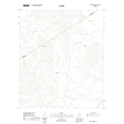
2019 Map of Ninetysix Ranch
USGS Topo · Published 2019About this map
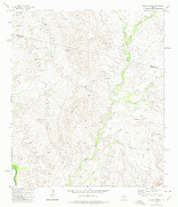
Ninetysix Ranch sits at a critical junction of high-desert terrain where the southern Lobo Valley meets the slopes of the Van Horn Mountains. This 2019 survey captures the essential water infrastructure of Far West Texas, documenting numerous vital points like Howard Tank, Jug Tank, and Baldy Tank that sustain life in this arid environment. The landscape is deeply carved by drainage systems, most notably Wilson Canyon and Ninetysix Canyon, which channel seasonal runoff toward Van Horn Cr. The diagonal border between Culberson County and Jeff Davis County cuts across the northern reaches of the quadrangle, illustrating how political boundaries overlay the natural topography of the Trans-Pecos. Access to this remote ranchland is maintained through traditional routes like Chispa Rd and the locally significant 96 Ranch Rd.
Find a feature on this map
19 named features on this map. Tap any name to fly to it.
Don’t see what you’re looking for? This feature index may not catch every label — zoom into the map to look around manually.
Map Details
Editions of this 2019 Ninetysix Ranch Map
This is the sole edition of this map. No revisions or reprints were ever made.
Other maps of this area

1892 · Chispa
USGS Topo · 1:125,000

1895 · Chispa
USGS Topo · 1:125,000

1897 · Chispa
USGS Topo · 1:125,000

1959 · Marfa
USGS Topo · 1:250,000

1965 · Marfa
USGS Topo · 1:250,000
1972 · Lobo
USGS Topo · 1:24,000
1972 · Lobo SW
USGS Topo · 1:24,000
1972 · Mesquite Spring
USGS Topo · 1:24,000
1972 · Soldier Spring
USGS Topo · 1:24,000

1972 · Chispa
USGS Topo · 1:24,000