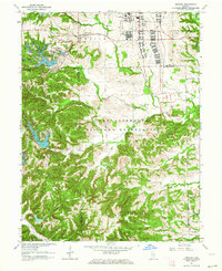
1962 Map of Nineveh
USGS Topo · Published 1964About this map
Camp Atterbury Military Reservation dominates the central landscape of this 1960s study, reflecting the significant military presence in south-central Indiana following World War II. The map reveals the internal structure of the post, including a Prisoner of War Camp and a U S Army Hospital, while documenting the surrounding rural transitions. To the northwest, the residential development of Princes Lakes stands in sharp contrast to the strictly organized military zones, featuring a dense network of water bodies such as Hants Lake and East Lake.
Find a feature on this map
46 named features on this map. Tap any name to fly to it.
Don’t see what you’re looking for? This feature index may not catch every label — zoom into the map to look around manually.
Map Details
Editions of this 1962 Nineveh Map
4 editions found
Other maps of this area

1942 · Franklin
USGS Topo · 1:125,000

1942 · Columbus
USGS Topo · 1:125,000

1947 · Nashville
USGS Topo · 1:24,000

1947 · Franklin
USGS Topo · 1:62,500

1948 · Franklin
USGS Topo · 1:24,000

1948 · Edinburg
USGS Topo · 1:24,000

1948 · New Bellsville
USGS Topo · 1:24,000

1948 · Trafalgar
USGS Topo · 1:24,000

1948 · Nineveh
USGS Topo · 1:24,000

1948 · Marietta
USGS Topo · 1:24,000