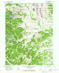
1962 Map of Nineveh
USGS Topo · Published 1967About this map
The Camp Atterbury Military Reservation dominates the central and southern reaches of this landscape, reflecting its mid-century role as a massive training and logistics hub. At the northern edge of the post, specialized facilities such as the U S Army Hospital and a Prisoner of War Camp remain clearly marked, highlighting the facility's wartime infrastructure. Just north of the reservation boundary, the town of Nineveh serves as a local anchor point, while the development of Princes Lakes and Sweetwater Lake illustrates the mid-century trend of reservoir creation for recreation and residence. This map captures the intersection of military utility and emerging rural subdivisions, with rugged terrain climbing toward Mt Moriah in the southwest and the Blue River cutting through the eastern corner. Local history and genealogy are preserved through landmarks like St Johns Ch and Kansas Cem, which sit alongside the shifting borders of Johnson, Brown, and Bartholomew counties.
Find a feature on this map
48 named features on this map. Tap any name to fly to it.
Don’t see what you’re looking for? This feature index may not catch every label — zoom into the map to look around manually.
Map Details
Editions of this 1962 Nineveh Map
4 editions found
Other maps of this area

1942 · Franklin
USGS Topo · 1:125,000

1942 · Columbus
USGS Topo · 1:125,000

1947 · Nashville
USGS Topo · 1:24,000

1947 · Franklin
USGS Topo · 1:62,500

1948 · Franklin
USGS Topo · 1:24,000

1948 · Edinburg
USGS Topo · 1:24,000

1948 · New Bellsville
USGS Topo · 1:24,000

1948 · Trafalgar
USGS Topo · 1:24,000

1948 · Nineveh
USGS Topo · 1:24,000

1948 · Marietta
USGS Topo · 1:24,000