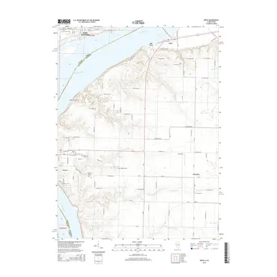
2015 Map of Niota
USGS Topo · Published 2015About this map
The Mississippi River forms a wide, sweeping border between Fort Madison, Iowa, and the Illinois riverbank settlements of Niota and Nauvoo. This 2015 survey reveals a landscape deeply connected to its regional heritage, particularly in the density of burial grounds near Nauvoo, including the Nauvoo City Cem, Pioneer Saints Cem, and the Saints Peter and Paul Cem. The transition from the urban grid of Fort Madison, with streets like Avenue N and Avenue P, to the agricultural townships of Hancock County is marked by a complex network of rural roads such as Frenchtown RD and Walnut Ridge RD. Local aviation is represented by two small facilities, Winchester Airport and Cedar Ridge Airport, while the interior terrain is carved by multiple drainage systems including Robinson Cr, Sycamore Cr, and Sheridan Cr. The small community of Powellton and the distinctively named Sinele Strip characterize the rural settlement patterns of the eastern Illinois uplands.
Find a feature on this map
80 named features on this map. Tap any name to fly to it.
Don’t see what you’re looking for? This feature index may not catch every label — zoom into the map to look around manually.
Map Details
Editions of this 2015 Niota Map
This is the sole edition of this map. No revisions or reprints were ever made.
Other maps of this area

1932 · Lomax
USGS Topo · 1:62,500

1933 · Carthage
USGS Topo · 1:62,500

1936 · Keokuk
USGS Topo · 1:62,500

1936 · Fort Madison
USGS Topo · 1:62,500

1937 · Carthage
USGS Topo · 1:62,500

1937 · Lomax
USGS Topo · 1:62,500

1950 · Keokuk
USGS Topo · 1:62,500

1958 · Burlington
USGS Topo · 1:250,000

1961 · Burlington
USGS Topo · 1:250,000

1963 · Burlington
USGS Topo · 1:250,000