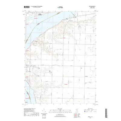
2018 Map of Niota
USGS Topo · Published 2018About this map
Mississippi River frontage defines this borderland landscape where Fort Madison and Galland, Iowa, face Niota and Nauvoo, Illinois. The arterial BNSF Railway crosses the river, connecting these riverfront communities and bypassing the historic core of Old Niota. This area is characterized by its numerous burial grounds and spiritual markers, including the Sacred Heart Cem, Appanoose Cem, and the Pioneer Saints Cem. Away from the river bluffs, the terrain levels into productive agricultural tracts bisected by a network of rural routes such as N Morman Springs Rd and N Co Rd 2770. Local aviation is represented by Winchester Airport and Cedar Ridge Airport, while natural drainage flows through winding corridors like Tyson Cr and Robinson Cr toward the Mississippi.
Find a feature on this map
65 named features on this map. Tap any name to fly to it.
Don’t see what you’re looking for? This feature index may not catch every label — zoom into the map to look around manually.
Map Details
Editions of this 2018 Niota Map
This is the sole edition of this map. No revisions or reprints were ever made.
Other maps of this area

1932 · Lomax
USGS Topo · 1:62,500

1933 · Carthage
USGS Topo · 1:62,500

1936 · Keokuk
USGS Topo · 1:62,500

1936 · Fort Madison
USGS Topo · 1:62,500

1937 · Carthage
USGS Topo · 1:62,500

1937 · Lomax
USGS Topo · 1:62,500

1950 · Keokuk
USGS Topo · 1:62,500

1958 · Burlington
USGS Topo · 1:250,000

1961 · Burlington
USGS Topo · 1:250,000

1963 · Burlington
USGS Topo · 1:250,000