2024 Map of Niota
USGS Topo · Published 2024About this map
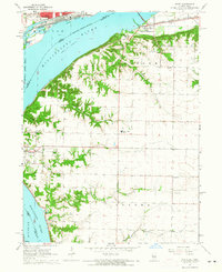
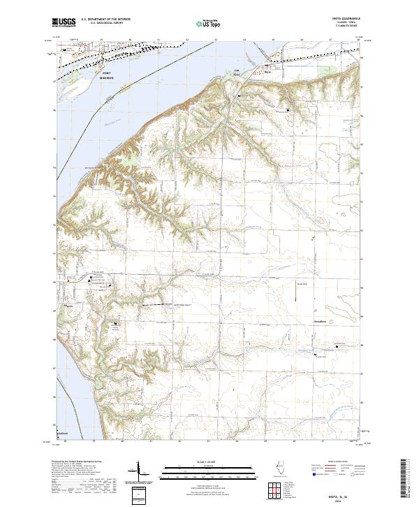
The Mississippi River forms a wide boundary between Illinois and Iowa, shaping the development of the historic riverfront communities of Nauvoo and Fort Madison. This area is characterized by a high concentration of sacred and burial sites, notably the Old Nauvoo Burial Grounds, Nauvoo's Old Cem, and Saints Peter and Paul Cem. The landscape transitions from the river flats up through Walnut Ridge and across fertile stretches like the Sinele Strip. Small settlements such as Niota, Old Niota, and Powellton are connected by a network of drainage systems including Tyson Creek, Robinson Creek, and Sycamore Creek. Local aviation is represented by Winchester Airport and Cedar Ridge Airport, while the BNSF Railway tracks the river’s edge, maintaining the region's long-standing connection to vital transport corridors.
Find a feature on this map
139 named features on this map. Tap any name to fly to it.
Don’t see what you’re looking for? This feature index may not catch every label — zoom into the map to look around manually.
Map Details
Editions of this 2024 Niota Map
This is the sole edition of this map. No revisions or reprints were ever made.
Historical Maps of Fort Madison Through Time
7 maps found