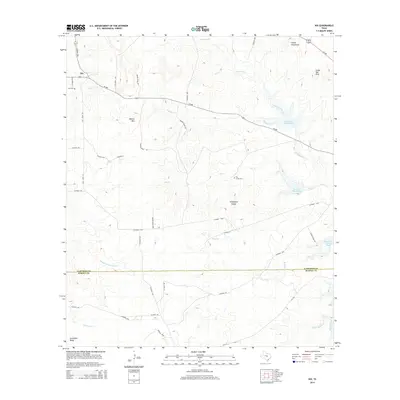
2014 Map of Nix
USGS Topo · Published 2014About this map
The small community of Nix sits in a landscape of high ridges and creek valleys along the border of Lampasas and Burnet Counties. A network of rural routes, including FM-580 and CO Road 1255, connects long-standing local landmarks such as Nix Cem and Pitt Creek Cem. The terrain is defined by prominent elevations like Waters Mtn, Cedar Top Peak, and the Carter Mountains, while drainage follows the paths of Donalson Creek and Pitt Cr. Several water features, including Reservoir Number One and Reservoir Number Two, reflect the region's managed water resources. Private landholdings like the Newton Rnch and descriptive landforms such as Graveyard Hollow and Goodland Ridge provide specific points of interest for those researching family connections or local geography in this part of the Texas Hill Country.
Find a feature on this map
49 named features on this map. Tap any name to fly to it.
Don’t see what you’re looking for? This feature index may not catch every label — zoom into the map to look around manually.
Map Details
Editions of this 2014 Nix Map
This is the sole edition of this map. No revisions or reprints were ever made.
Other maps of this area

1887 · Lampasas
USGS Topo · 1:125,000

1887 · Burnet
USGS Topo · 1:125,000

1893 · Burnet
USGS Topo · 1:125,000

1894 · Lampasas
USGS Topo · 1:125,000

1903 · Burnet
USGS Topo · 1:125,000

1909 · Burnet
USGS Topo · 1:125,000

1932 · Tow
USGS Topo · 1:62,500

1954 · Brownwood
USGS Topo · 1:250,000

1954 · Lampasas
USGS Topo · 1:62,500

1954 · Lampasas
USGS Topo · 1:24,000