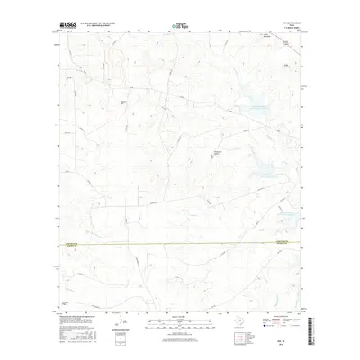
2016 Map of Nix
USGS Topo · Published 2016About this map
The small settlement of Nix serves as the focal point for this rural survey of the Lampasas and Burnet County borderlands. Located near the headwaters of Lynch Cr, the community is anchored by the Nix Cem, reflecting the area's deep-rooted ranching and farming history. The landscape is defined by its topographic prominence, including Waters Mtn and Cedar Top Peak in the north, and Goodland Ridge to the south. Water management infrastructure is a significant feature of this modern era, evidenced by three distinct reservoirs including Soil Conservation Service Site 1 Reservoir. Genealogists may find interest in the isolated Pitt Creek Cem tucked away in Graveyard Hollow, while the extensive network of county roads like McCreaville Rd and ranch roads provides a clear view of contemporary land divisions and access in the Texas Hill Country.
Find a feature on this map
46 named features on this map. Tap any name to fly to it.
Don’t see what you’re looking for? This feature index may not catch every label — zoom into the map to look around manually.
Map Details
Editions of this 2016 Nix Map
This is the sole edition of this map. No revisions or reprints were ever made.
Other maps of this area

1887 · Lampasas
USGS Topo · 1:125,000

1887 · Burnet
USGS Topo · 1:125,000

1893 · Burnet
USGS Topo · 1:125,000

1894 · Lampasas
USGS Topo · 1:125,000

1903 · Burnet
USGS Topo · 1:125,000

1909 · Burnet
USGS Topo · 1:125,000

1932 · Tow
USGS Topo · 1:62,500

1954 · Brownwood
USGS Topo · 1:250,000

1954 · Lampasas
USGS Topo · 1:62,500

1954 · Lampasas
USGS Topo · 1:24,000