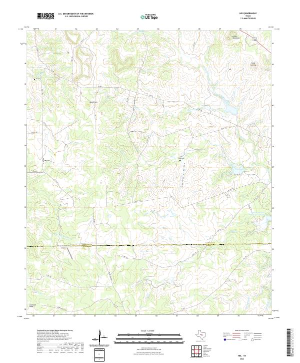
2022 Map of Nix
USGS Topo · Published 2022About this map
The Lampasas Co and Burnet Co line bisects this landscape, marking a transition between the elevated peaks of the Texas Hill Country and the creek-fed valleys below. Significant topographical features like Waters Mtn and Carter Mountains dominate the northern terrain, while the southern portion is defined by the drainage of Middle Fork Yancey Cr and Pillar Bluff Cr. The rural character of the area is anchored by the Yancey Creek Ranch Airport and a network of county roads that follow the natural contours of the ridges and hollows.
Find a feature on this map
45 named features on this map. Tap any name to fly to it.
Don’t see what you’re looking for? This feature index may not catch every label — zoom into the map to look around manually.
Map Details
Editions of this 2022 Nix Map
This is the sole edition of this map. No revisions or reprints were ever made.
Other maps of this area

1887 · Lampasas
USGS Topo · 1:125,000

1887 · Burnet
USGS Topo · 1:125,000

1893 · Burnet
USGS Topo · 1:125,000

1894 · Lampasas
USGS Topo · 1:125,000

1903 · Burnet
USGS Topo · 1:125,000

1909 · Burnet
USGS Topo · 1:125,000

1932 · Tow
USGS Topo · 1:62,500

1954 · Brownwood
USGS Topo · 1:250,000

1954 · Lampasas
USGS Topo · 1:62,500

1954 · Lampasas
USGS Topo · 1:24,000