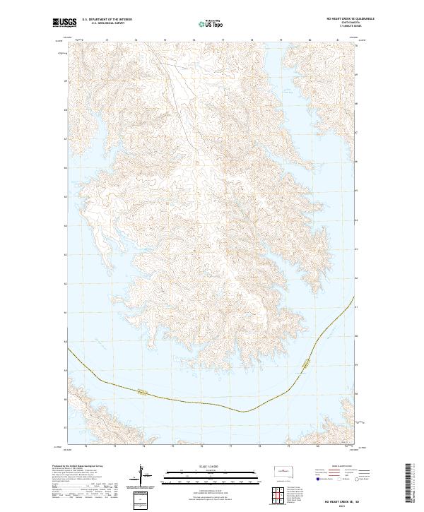
2021 Map of No Heart Creek SE
USGS Topo · Published 2021About this map
Lake Oahe dominates the southern reaches of this landscape, marking the flooded valley of the Missouri River where it forms the boundary between Dewey County and Sully County. The topography is defined by the intricate, finger-like inlets created by the rising waters of the reservoir, most notably at Willow Creek Bay in the northeast. This 2021 survey illustrates the modern shoreline where the Missouri's course was permanently altered, showing how secondary drainages like Fairbanks Cr and Splits Cr now feed directly into the expansive lake. The map provides a clear view of the Public Land Survey System grid that organizes this prairie terrain, intersected by the lone named corridor of 182nd St as it approaches the river bluffs from the east.
Find a feature on this map
15 named features on this map. Tap any name to fly to it.
Don’t see what you’re looking for? This feature index may not catch every label — zoom into the map to look around manually.
Map Details
Editions of this 2021 No Heart Creek SE Map
This is the sole edition of this map. No revisions or reprints were ever made.
Other maps of this area

1954 · Pierre
USGS Topo · 1:250,000

1958 · Pierre
USGS Topo · 1:250,000

1965 · Artichoke Butte SW
USGS Topo · 1:24,000

1965 · Okobojo
USGS Topo · 1:24,000

1969 · No Heart Creek SE
USGS Topo · 1:24,000

1969 · Artichoke Butte NW
USGS Topo · 1:24,000

1969 · No Heart Creek SW
USGS Topo · 1:24,000

1973 · Iron Post Buttes
USGS Topo · 1:24,000
1973 · Mail Shack Creek
USGS Topo · 1:24,000
1981 · No Heart Creek NE
USGS Topo · 1:24,000