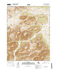
2015 Map of Noatak B-1 SE
USGS Topo · Published 2015About this map
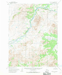
The Noatak National Preserve encompasses most of this landscape, protecting an area of the Arctic where high-latitude drainage systems define the movement of water and life. The Squirrel River flows across the northern reaches of the map, while the southern terrain is dominated by the elevations of the Igichuk Hills. This 2015 survey illustrates a wilderness nearly untouched by permanent infrastructure, organized by the township and range lines of the Public Land Survey System such as t22n r16w. Local watercourses like Hugo Cr carve through the contours of the hills, providing a detailed record of the hydrography in the Northwest Arctic Borough during the early 21st century.
Find a feature on this map
10 named features on this map. Tap any name to fly to it.
Don’t see what you’re looking for? This feature index may not catch every label — zoom into the map to look around manually.
Map Details
Editions of this 2015 Noatak B-1 SE Map
This is the sole edition of this map. No revisions or reprints were ever made.
Other maps of this area

1951 · Baird Mountains
USGS Topo · 1:250,000

1951 · Noatak
USGS Topo · 1:250,000

1955 · Noatak
USGS Topo · 1:250,000
1955 · Baird Mountains A-6
USGS Topo · 1:63,360
1955 · Baird Mountains B-6
USGS Topo · 1:63,360
1955 · Noatak A-1
USGS Topo · 1:63,360
1955 · Noatak B-1
USGS Topo · 1:63,360

1956 · Baird Mountains
USGS Topo · 1:250,000

1964 · Noatak
USGS Topo · 1:250,000

1965 · Baird Mountains
USGS Topo · 1:250,000