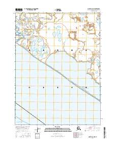
2016 Map of Noatak C-5 NW
USGS Topo · Published 2016About this map
The coastal settlement of Kivalina sits at the edge of this Arctic landscape, where the Wulik River meets the expansive Chukchi Sea. This 2016 survey illustrates a delicate environment of low-lying wetlands and shallow water bodies, including Kaglugrak Deep and Kograk Deep to the north. A significant portion of the map is defined by the Singigrak Spit, a narrow landform that separates the open sea from Imikruk Lagoon, providing a vital geographical buffer for the inland tundra. The intricate network of surface water, from the Nuyakaglik Lakes to Kikiktauralik Lake, suggests a complex hydrologic system typical of this northern latitude, where even minor elevation changes dictate the flow of Imikruk Cr. This record is essential for understanding the shifting relationship between the shoreline and the community in one of the most dynamic coastal regions of the Northwest Arctic Borough.
Find a feature on this map
13 named features on this map. Tap any name to fly to it.
Don’t see what you’re looking for? This feature index may not catch every label — zoom into the map to look around manually.
Map Details
Editions of this 2016 Noatak C-5 NW Map
This is the sole edition of this map. No revisions or reprints were ever made.
Other maps of this area

1951 · Noatak
USGS Topo · 1:250,000
1952 · Noatak C-5
USGS Topo · 1:63,360

1955 · Noatak
USGS Topo · 1:250,000
1955 · Noatak D-6
USGS Topo · 1:63,360
1955 · Noatak D-5
USGS Topo · 1:63,360

1964 · Noatak
USGS Topo · 1:250,000
2014 · Noatak D-6 SE
USGS Topo · 1:25,000
2014 · Noatak C-5 OE W NE
USGS Topo · 1:25,000
2014 · Noatak D-5 SW
USGS Topo · 1:25,000
2014 · Noatak D-5 SE
USGS Topo · 1:25,000