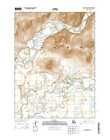
2014 Map of Noatak D-5 SW
USGS Topo · Published 2014About this map
The Kivalina River and Wulik River dominate this portion of the Northwest Arctic, showcasing the intricate drainage patterns of the Alaskan tundra in the early 21st century. The landscape is defined by low-lying wetlands and meandering river channels that shift across the coastal plain. Significant topographic elevations rise above the surrounding water-logged terrain, including Kisimigiuktuk Hill and Simik Hill, which serve as prominent landmarks in an otherwise low-profile environment.
Find a feature on this map
14 named features on this map. Tap any name to fly to it.
Don’t see what you’re looking for? This feature index may not catch every label — zoom into the map to look around manually.
Map Details
Editions of this 2014 Noatak D-5 SW Map
This is the sole edition of this map. No revisions or reprints were ever made.
Other maps of this area

1951 · Noatak
USGS Topo · 1:250,000
1952 · Noatak C-5
USGS Topo · 1:63,360

1955 · Noatak
USGS Topo · 1:250,000
1955 · Noatak D-6
USGS Topo · 1:63,360
1955 · Noatak D-5
USGS Topo · 1:63,360

1964 · Noatak
USGS Topo · 1:250,000
2014 · Noatak D-6 SE
USGS Topo · 1:25,000
2014 · Noatak D-5 NE
USGS Topo · 1:25,000
2014 · Noatak D-5 NW
USGS Topo · 1:25,000
2014 · Noatak C-5 OE W NE
USGS Topo · 1:25,000