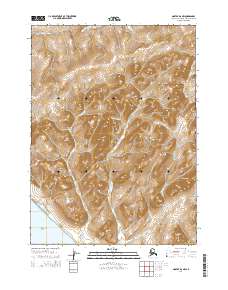
2014 Map of Noatak D-6 NW
USGS Topo · Published 2014About this map
The Chukchi Sea coastline meets a complex network of coastal lagoons and coastal foothills in this 2014 survey. The landscape is defined by its transition from the marine environment of Kavrorak Lagoon and Tugak Lagoon to the prominent heights of the Parents Mountains and Pusaluk Mountain. The drainage patterns are clearly marked by seasonal watercourses including the Singoalik River in the north and the Umarachek Cr system to the south. Distinctive geological landmarks such as Itiptigvirak Neck and the Siaktak Hills provide a clear view of the shoreward terrain in the Northwest Arctic Borough. This modern digital survey by the U.S. Geological Survey captures the untouched character of the region, emphasizing the relationships between small coastal hills like Igrak Hill and the broader watershed of Tatigirok Cr.
Find a feature on this map
19 named features on this map. Tap any name to fly to it.
Don’t see what you’re looking for? This feature index may not catch every label — zoom into the map to look around manually.
Map Details
Editions of this 2014 Noatak D-6 NW Map
This is the sole edition of this map. No revisions or reprints were ever made.
Other maps of this area

1951 · De Long Mountains
USGS Topo · 1:250,000

1951 · Noatak
USGS Topo · 1:250,000

1952 · Point Hope
USGS Topo · 1:250,000
1952 · Noatak D-7
USGS Topo · 1:63,360

1955 · Noatak
USGS Topo · 1:250,000

1955 · De Long Mountains
USGS Topo · 1:250,000

1955 · Point Hope
USGS Topo · 1:250,000

1955 · Point Hope A-1
USGS Topo · 1:63,360
1955 · Noatak D-6
USGS Topo · 1:63,360
1955 · De Long Mountains A-5
USGS Topo · 1:63,360