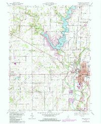
1969 Map of Noblesville
USGS Topo · Published 1987About this map
The White River and the expanding Morse Reservoir define the landscape of Hamilton County in this late 1960s revision. The city of Noblesville serves as a focal point, showing established residential grids and its historical Courthouse, while the newly developed Monterey Village and Federal Hill reflect mid-century growth patterns. To the north, the reservoir has reshaped the drainage of Cicero Creek and Hinkle Creek, creating a new recreational geography seen in the Indianapolis Boys Club Camp and the Morse Reservoir Golf Course.
Find a feature on this map
61 named features on this map. Tap any name to fly to it.
Don’t see what you’re looking for? This feature index may not catch every label — zoom into the map to look around manually.
Map Details
Editions of this 1969 Noblesville Map
3 editions found
Other maps of this area

1952 · Fishers
USGS Topo · 1:24,000

1952 · Carmel
USGS Topo · 1:24,000

1952 · Mc Cordsville
USGS Topo · 1:24,000

1953 · Westfield
USGS Topo · 1:24,000

1953 · Riverwood
USGS Topo · 1:24,000

1953 · Noblesville
USGS Topo · 1:24,000

1953 · Cincinnati
USGS Topo · 1:250,000

1953 · Danville
USGS Topo · 1:250,000

1953 · Indianapolis
USGS Topo · 1:250,000

1953 · Muncie
USGS Topo · 1:250,000