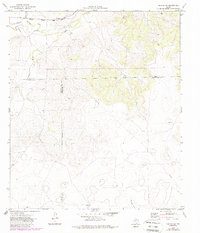
1971 Map of Noelke SW
USGS Topo · Published 1988About this map
The Atchison Topeka and Santa Fe railroad cuts across the northern edge of this West Texas landscape, skirting the drainage of Spring Creek and Dutch Woman Draw. This 1971 survey captures a sparsely populated region where Irion, Crockett, and Schleicher counties meet along an Indefinite Boundary. The economy of the era is marked by intermittent oil wells and a persistent network of pipelines that cross the high plateaus and draws. Significant topographic landmarks like O-Nine Draw and the prominent Monument in the northeast indicate the orientation of cattle ranching and resource extraction in this arid environment. Surveyors noted fine details of land management, including numerous fence lines and a Gravel Pit, providing a specialized record of the terrain before late 20th-century developments reached this portion of the Edwards Plateau.
Find a feature on this map
16 named features on this map. Tap any name to fly to it.
Don’t see what you’re looking for? This feature index may not catch every label — zoom into the map to look around manually.
Map Details
Editions of this 1971 Noelke SW Map
2 editions found
Other maps of this area

1895 · Sherwood
USGS Topo · 1:125,000

1920 · Barnhart
USGS Topo · 1:62,500

1922 · Barnhart
USGS Topo · 1:62,500

1954 · Sonora
USGS Topo · 1:250,000

1954 · San Angelo
USGS Topo · 1:250,000

1958 · Sonora
USGS Topo · 1:250,000

1958 · San Angelo
USGS Topo · 1:250,000

1964 · Oglesby Ranch
USGS Topo · 1:24,000

1964 · Moore Ranch
USGS Topo · 1:24,000

1965 · San Angelo
USGS Topo · 1:250,000