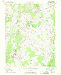
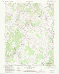
1966 Map of Nokesville
USGS Topo · Published 1969About this map
Southern railroad tracks bisect this Prince William County landscape, connecting the village of Nokesville to Bristow as the region maintained its agricultural character in the mid-1960s. The map reveals a community defined by its watercourses, notably Broad Run, Kettle Run, and Cedar Run, which delineate the terrain and supported early local industry at sites like Daniels Mill. To the south, the presence of Quantico Marine Corps Schools and Camp Upshur indicates the encroaching federal footprint near the Prince William Co / Fauquier Co border.
Find a feature on this map
31 named features on this map. Tap any name to fly to it.
Don’t see what you’re looking for? This feature index may not catch every label — zoom into the map to look around manually.
Map Details
Editions of this 1966 Nokesville Map
5 editions found
Other maps of this area

1890 · Mt. Vernon
USGS Topo · 1:125,000

1891 · Mt. Vernon
USGS Topo · 1:125,000

1894 · Warrenton
USGS Topo · 1:125,000

1894 · Mt. Vernon
USGS Topo · 1:125,000

1897 · Mt. Vernon
USGS Topo · 1:125,000

1915 · Fairfax
USGS Topo · 1:62,500

1927 · Quantico
USGS Topo · 1:62,500

1933 · Middleburg
USGS Topo · 1:62,500

1940 · Quantico
USGS Topo · 1:62,500

1943 · Quantico
USGS Topo · 1:62,500