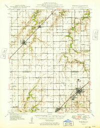
1949 Map of Nokomis
USGS Topo · Published 1949About this map
Nokomis, Coalton, and Witt anchor the southeastern corner of this Illinois prairie landscape, where the New Central road and the Wabash railroad carved paths through the fertile agricultural heartland of Christian and Montgomery Counties. The map reveals an exceptionally dense network of rural one-room schoolhouses, such as Hazel Green Sch, Oak Ridge Sch, and Prosperity Sch, serving a farm-based population just after World War II.
Find a feature on this map
79 named features on this map. Tap any name to fly to it.
Don’t see what you’re looking for? This feature index may not catch every label — zoom into the map to look around manually.
Map Details
Editions of this 1949 Nokomis Map
2 editions found

Other maps of this area

1915 · Mount Olive
USGS Topo · 1:62,500

1922 · Divernon
USGS Topo · 1:62,500

1923 · Taylorville
USGS Topo · 1:62,500

1923 · Raymond
USGS Topo · 1:62,500

1924 · Divernon
USGS Topo · 1:62,500

1925 · Taylorville
USGS Topo · 1:62,500

1925 · Raymond
USGS Topo · 1:62,500

1944 · Mount Olive
USGS Topo · 1:62,500

1944 · Ramsey
USGS Topo · 1:62,500

1946 · Ramsey
USGS Topo · 1:62,500