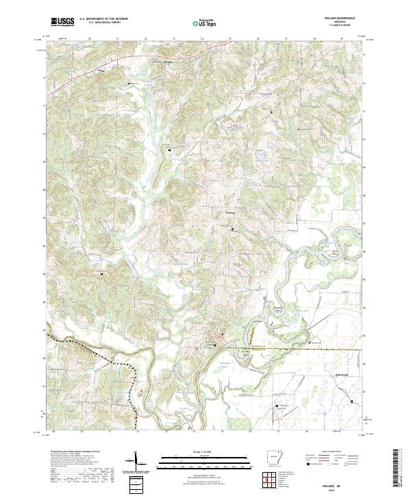
2024 Map of Noland
USGS Topo · Published 2024About this map
The Eleven Point River and the Spring River converge in this corner of Northeast Arkansas, creating a landscape defined by dramatic bends and oxbow lakes. The Black River also winds through the eastern portion, forming features such as Deadman Bend and Scotts Bend. This confluence was historically vital for transit, evidenced by the proximity of several rural communities like Birdell, Noland, and Richwoods.
Find a feature on this map
97 named features on this map. Tap any name to fly to it.
Don’t see what you’re looking for? This feature index may not catch every label — zoom into the map to look around manually.
Map Details
Editions of this 2024 Noland Map
This is the sole edition of this map. No revisions or reprints were ever made.
Other maps of this area

1932 · Walnut Ridge
USGS Topo · 1:62,500

1934 · Powhatan
USGS Topo · 1:62,500

1935 · Powhatan
USGS Topo · 1:62,500

1935 · Reyno
USGS Topo · 1:62,500

1935 · Walnut Ridge
USGS Topo · 1:62,500

1957 · Poplar Bluff
USGS Topo · 1:250,000

1959 · Poplar Bluff
USGS Topo · 1:250,000

1960 · Poplar Bluff
USGS Topo · 1:250,000
1965 · Walnut Ridge
USGS Topo · 1:24,000
1965 · Manson
USGS Topo · 1:24,000