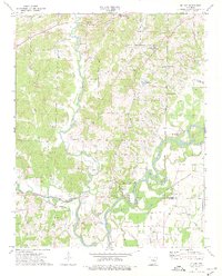
1974 Map of Noland
USGS Topo · Published 1976About this map
Old Davidsonville State Park sits at the heart of this landscape where the Eleven Point River joins the Spring River, marking a site of early Arkansas settlement history. The terrain is defined by complex river hydrology, featuring oxbows and named reaches like Deadman Bend and Scotts Bend, alongside several floodplain lakes including Wilson Lake and Bull Pizzle Lake. These waterways were critical to the development of early outposts like Noland and Birdell.
Find a feature on this map
50 named features on this map. Tap any name to fly to it.
Don’t see what you’re looking for? This feature index may not catch every label — zoom into the map to look around manually.
Map Details
Editions of this 1974 Noland Map
This is the sole edition of this map. No revisions or reprints were ever made.
Other maps of this area

1932 · Walnut Ridge
USGS Topo · 1:62,500

1934 · Powhatan
USGS Topo · 1:62,500

1935 · Powhatan
USGS Topo · 1:62,500

1935 · Reyno
USGS Topo · 1:62,500

1935 · Walnut Ridge
USGS Topo · 1:62,500

1957 · Poplar Bluff
USGS Topo · 1:250,000

1959 · Poplar Bluff
USGS Topo · 1:250,000

1960 · Poplar Bluff
USGS Topo · 1:250,000
1965 · Walnut Ridge
USGS Topo · 1:24,000
1965 · Manson
USGS Topo · 1:24,000