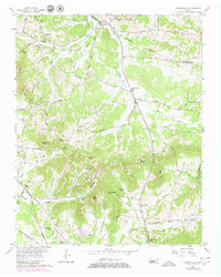
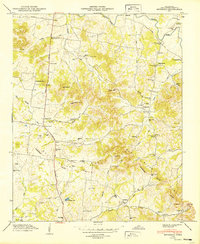
1957 Map of Nolensville
USGS Topo · Published 1980About this map
Mill Creek carves a central path through this Tennessee landscape, where rural life in the late 1950s is defined by a dense network of family-named cemeteries and crossroads churches. The settlement of Nolensville serves as a primary hub, supported by the Nolensville Sch and Nolensville Ch. Further south, the community of Arrington sits near the crossing of Arrington Creek. The terrain is punctuated by distinctive rises such as McMahan Knob and Chinquapin Hill, which overlook various hollows like Burke Hollow and Warren Hollow.
Find a feature on this map
73 named features on this map. Tap any name to fly to it.
Don’t see what you’re looking for? This feature index may not catch every label — zoom into the map to look around manually.
Map Details
Editions of this 1957 Nolensville Map
4 editions found
Other maps of this area

1903 · Nashville
USGS Topo · 1:125,000

1909 · Franklin
USGS Topo · 1:62,500

1932 · Hermitage
USGS Topo · 1:62,500

1932 · Nashville
USGS Topo · 1:62,500

1936 · Bethesda
USGS Topo · 1:24,000

1942 · Lebanon
USGS Topo · 1:100,000

1946 · Bethesda
USGS Topo · 1:24,000

1949 · Franklin
USGS Topo · 1:24,000
1949 · Bethesda
USGS Topo · 1:24,000

1952 · La Vergne
USGS Topo · 1:24,000