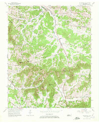
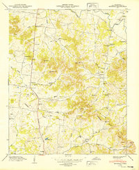
1957 Map of Nolensville
USGS Topo · Published 1972About this map
Mill Creek meanders northward through the heart of this mid-century landscape, anchoring a rural community defined by family farms and country crossroads. The settlement of Nolensville serves as the primary hub, where the Nolensville Sch and Nolensville Ch stand near the intersection of local pikes. The terrain is marked by a series of prominent elevations, including Potato Hill and McMahan Knob, which shaped the early road network and property boundaries between the Davidson, Williamson, and Rutherford county lines.
Find a feature on this map
68 named features on this map. Tap any name to fly to it.
Don’t see what you’re looking for? This feature index may not catch every label — zoom into the map to look around manually.
Map Details
Editions of this 1957 Nolensville Map
4 editions found
Other maps of this area

1903 · Nashville
USGS Topo · 1:125,000

1909 · Franklin
USGS Topo · 1:62,500

1932 · Hermitage
USGS Topo · 1:62,500

1932 · Nashville
USGS Topo · 1:62,500

1936 · Bethesda
USGS Topo · 1:24,000

1942 · Lebanon
USGS Topo · 1:100,000

1946 · Bethesda
USGS Topo · 1:24,000

1949 · Franklin
USGS Topo · 1:24,000
1949 · Bethesda
USGS Topo · 1:24,000

1952 · La Vergne
USGS Topo · 1:24,000