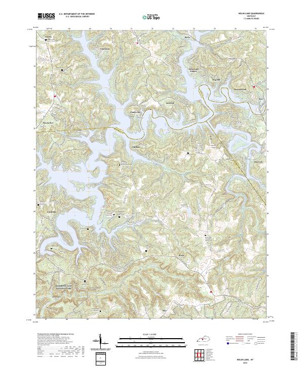
2022 Map of Nolin Lake
USGS Topo · Published 2022About this map
Mammoth Cave National Park defines the southern boundary of this region, where the Nolin River winds through the hills of Edmonson and Grayson counties. The landscape is marked by numerous family-named cemeteries and small community churches, reflecting a deeply rooted local genealogy in settlements like Anneta, Moutardier, and Straw. The map captures the specialized geography of Nolin Lake, with its many coves such as Cubby Cove and the development of lakeside communities like Linwood Park and Nolin Lake Estates. Transportation and local infrastructure are represented by the Lakeview Airport and a network of secondary roads including Iberia Rd and Cub Run Rd. Significant natural landmarks such as Whistle Mtn and the Chimney Stack overlook the Cove Hollow area, illustrating the complex terrain surrounding the river's path through south-central Kentucky.
Find a feature on this map
115 named features on this map. Tap any name to fly to it.
Don’t see what you’re looking for? This feature index may not catch every label — zoom into the map to look around manually.
Map Details
Editions of this 2022 Nolin Lake Map
This is the sole edition of this map. No revisions or reprints were ever made.
Other maps of this area

1922 · Leitchfield
USGS Topo · 1:48,000

1922 · Brownsville
USGS Topo · 1:62,500

1922 · Mammoth Cave
USGS Topo · 1:62,500

1923 · Mammoth Cave
USGS Topo · 1:62,500

1923 · Brownsville
USGS Topo · 1:62,500

1925 · Cub Run
USGS Topo · 1:62,500

1925 · Leitchfield
USGS Topo · 1:62,500

1953 · Bee Spring
USGS Topo · 1:24,000

1954 · Evansville
USGS Topo · 1:250,000
1954 · Dickeys Mills
USGS Topo · 1:24,000