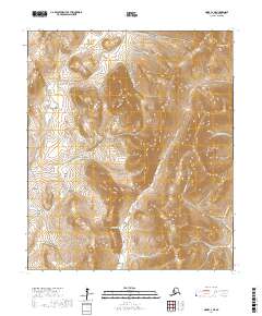
2017 Map of Nome C-2 NE
USGS Topo · Published 2017About this map
The Seward Peninsula landscape is defined by the complex drainage systems and gulches that surround Aurora Mtn. This area near Nome is dominated by the catchments of the Cripple River and Penny River, which are fed by numerous small creeks including Slate Cr, Gold Run, and Daisy Swift Cr. The terrain is deeply incised with prospector-named features like Snowshoe Gulch, Nugget Gulch, and Trilby Gulch, suggesting a history of mineral exploration throughout the region.
Find a feature on this map
35 named features on this map. Tap any name to fly to it.
Don’t see what you’re looking for? This feature index may not catch every label — zoom into the map to look around manually.
Map Details
Editions of this 2017 Nome C-2 NE Map
This is the sole edition of this map. No revisions or reprints were ever made.
Other maps of this area

1950 · Nome D-2
USGS Topo · 1:63,360

1950 · Nome
USGS Topo · 1:250,000

1950 · Nome D-1
USGS Topo · 1:63,360

1950 · Nome C-2
USGS Topo · 1:63,360

1950 · Nome C-1
USGS Topo · 1:63,360

1951 · Nome
USGS Topo · 1:250,000

1957 · Nome
USGS Topo · 1:250,000
1972 · Nome D-1
USGS Topo · 1:63,360
2017 · Nome D-1 SW
USGS Topo · 1:25,000
2017 · Nome C-1 SW
USGS Topo · 1:25,000