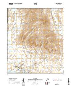
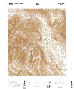
2017 Map of Nome C-1 SW
USGS Topo · Published 2017About this map
Nome serves as the focal point of this coastal survey, where the town's urban grid meets the waters of Norton Sound. The landscape is defined by its gold-rush history, evidenced by a dense network of roads and spurs that reach deep into the interior gulches and peaks. Key thoroughfares such as the Nome-Teller Highway and Kougarok Road diverge from the coast to navigate the complex terrain. The map traces the winding paths of the Snake River and Nome River, which frame the low-lying coastal flats before the elevation rises sharply toward Anvil Mtn and Banner Peak. Local heritage is visible in the placement of the Nome City Cem and the settlement at Perkinsville, while modern infrastructure is represented by the Nome Airport and Nome City Field. From the drainage of Glacier Cr to the heights of Dexter Peak, the map documents a region where industry and settlement are inextricably linked to the geography of the Seward Peninsula.
Find a feature on this map
110 named features on this map. Tap any name to fly to it.
Don’t see what you’re looking for? This feature index may not catch every label — zoom into the map to look around manually.
Map Details
Editions of this 2017 Nome C-1 SW Map
This is the sole edition of this map. No revisions or reprints were ever made.
Other maps of this area

1950 · Nome
USGS Topo · 1:250,000

1950 · Nome B-1
USGS Topo · 1:63,360

1950 · Nome C-2
USGS Topo · 1:63,360

1950 · Nome C-1
USGS Topo · 1:63,360

1951 · Nome
USGS Topo · 1:250,000

1957 · Nome
USGS Topo · 1:250,000
2017 · Nome C-2 NE
USGS Topo · 1:25,000
2017 · Nome C-1 NW
USGS Topo · 1:25,000
2017 · Nome C-1 SE
USGS Topo · 1:25,000
2017 · Nome C-1 NE
USGS Topo · 1:25,000