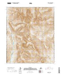
2017 Map of Nome D-1 SE
USGS Topo · Published 2017About this map
The Nome Mountains dominate this interior landscape of the Seward Peninsula, where a network of gold-rush-era named creeks carves through the upland terrain. The western edge of the quadrangle is defined by the Nome River valley, which serves as a natural corridor for the Kougarok Road / Nome-Taylor Highway. This route provides access to the remote backcountry, passing by landforms such as Little Gulch and July Gulch.
Find a feature on this map
28 named features on this map. Tap any name to fly to it.
Don’t see what you’re looking for? This feature index may not catch every label — zoom into the map to look around manually.
Map Details
Editions of this 2017 Nome D-1 SE Map
This is the sole edition of this map. No revisions or reprints were ever made.
Other maps of this area

1950 · Nome
USGS Topo · 1:250,000

1950 · Solomon C-6
USGS Topo · 1:63,360

1950 · Solomon
USGS Topo · 1:250,000

1950 · Solomon D-6
USGS Topo · 1:63,360

1950 · Nome D-1
USGS Topo · 1:63,360

1950 · Nome C-1
USGS Topo · 1:63,360

1951 · Nome
USGS Topo · 1:250,000

1951 · Solomon
USGS Topo · 1:250,000

1957 · Nome
USGS Topo · 1:250,000
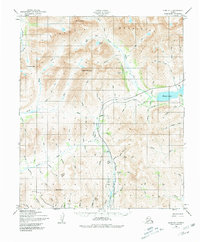
1972 · Nome D-1
USGS Topo · 1:63,360