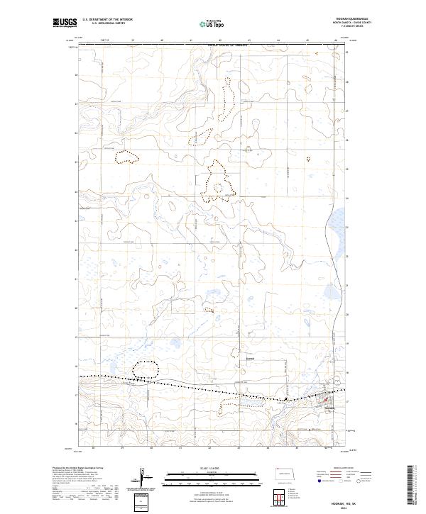
2024 Map of Noonan
USGS Topo · Published 2024About this map
Noonan sits at the southern edge of this North Dakota prairie landscape, where the grid of the town site meets the wide-open spaces of Divide County Waterfowl Production Area. The town's layout is defined by its core streets, including Main St and Atlantic Ave, which connect the local community to the surrounding agricultural land. Just to the west, the smaller settlement of Kermit is situated near the 102nd St NW corridor.
Find a feature on this map
33 named features on this map. Tap any name to fly to it.
Don’t see what you’re looking for? This feature index may not catch every label — zoom into the map to look around manually.
Map Details
Editions of this 2024 Noonan Map
This is the sole edition of this map. No revisions or reprints were ever made.
Other maps of this area

1947 · Noonan
USGS Topo · 1:24,000

1949 · Columbus SW
USGS Topo · 1:24,000

1949 · Paulson
USGS Topo · 1:24,000

1949 · Atcoal
USGS Topo · 1:24,000

1949 · Noonan SW
USGS Topo · 1:24,000

1949 · Noonan SE
USGS Topo · 1:24,000

1949 · Noonan
USGS Topo · 1:24,000

1950 · Columbus
USGS Topo · 1:62,500

1950 · Noonan
USGS Topo · 1:62,500

1953 · Williston
USGS Topo · 1:250,000