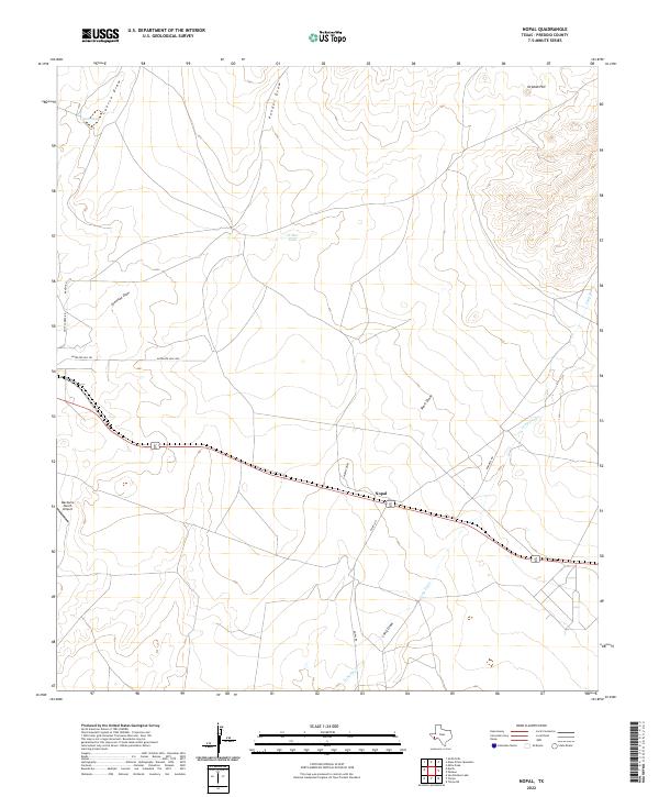
2022 Map of Nopal
USGS Topo · Published 2022About this map
Nopal sits at a remote high-desert junction in Presidio County, defined by the meeting of several significant seasonal watercourses and local ranch roads. The landscape is carved by deep drainages such as Cuervo Draw, Ponder Draw, and the extensive Long Draw, which dominate the local topography alongside Orphan Hill. This area represents the quintessential West Texas ranching environment, where infrastructure is centered around managed water sources like Catto Tank and W-Bar Tank. Human activity is primarily oriented along the shared corridor of 67 90 and secondary routes like Nopal Rd. The presence of the MacGuire Ranch Airport underscores the vast distances typical of this region, where aerial transport remains a functional necessity for remote properties. This map preserves the contemporary layout of road networks like Antelope Hills Rd and Donnell Rd, tracing the vital connections between isolated desert outposts.
Find a feature on this map
18 named features on this map. Tap any name to fly to it.
Don’t see what you’re looking for? This feature index may not catch every label — zoom into the map to look around manually.
Map Details
Editions of this 2022 Nopal Map
This is the sole edition of this map. No revisions or reprints were ever made.
Other maps of this area

1895 · Marfa
USGS Topo · 1:125,000

1895 · Alpine
USGS Topo · 1:125,000

1954 · Fort Stockton
USGS Topo · 1:250,000

1958 · Fort Stockton
USGS Topo · 1:250,000

1959 · Marfa
USGS Topo · 1:250,000

1965 · Marfa
USGS Topo · 1:250,000

1972 · Paisano
USGS Topo · 1:24,000

1972 · Mitre Peak
USGS Topo · 1:24,000

1972 · Nopal
USGS Topo · 1:24,000
1972 · Mano Prieto Mountain
USGS Topo · 1:24,000