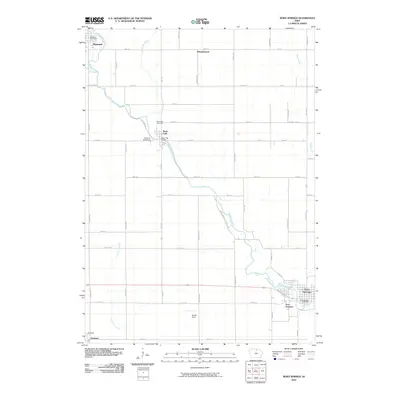
2010 Map of Nora Springs
USGS Topo · Published 2010About this map
The Shell Rock River meanders diagonally across this North Central Iowa landscape, serving as the central geographic feature for the communities of Nora Springs and Rock Falls. In the southeast, Nora Junction remains a distinct point near the larger settlement of Nora Springs, reflecting the region's historical reliance on transportation corridors. The rural grid is punctuated by small, established locales such as Wheelerwood in the north and Portland in the southwest corner. Local landmarks like the Rock Falls Bridge and Rock Falls Cemetery provide specific points of interest for genealogists and local historians. The map also identifies recreational and community spaces, including Camp at the Woods along the river and Spotts Field further south, illustrating the mix of residential life and natural riparian terrain.
Find a feature on this map
39 named features on this map. Tap any name to fly to it.
Don’t see what you’re looking for? This feature index may not catch every label — zoom into the map to look around manually.
Map Details
Editions of this 2010 Nora Springs Map
This is the sole edition of this map. No revisions or reprints were ever made.
Other maps of this area

1954 · Mason City
USGS Topo · 1:250,000

1957 · Mason City
USGS Topo · 1:250,000

1958 · Mason City
USGS Topo · 1:250,000

1959 · Mason City
USGS Topo · 1:24,000

1959 · Mason City
USGS Topo · 1:62,500

1959 · Nora Springs
USGS Topo · 1:24,000

1959 · Mason City SE
USGS Topo · 1:24,000

1959 · Hanford
USGS Topo · 1:24,000

1971 · Rockford
USGS Topo · 1:24,000

1971 · Rudd
USGS Topo · 1:24,000