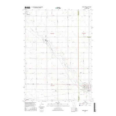
2015 Map of Nora Springs
USGS Topo · Published 2015About this map
The Shell Rock River winds southeastward through Cerro Gordo and Floyd counties, acting as the primary geographical anchor for the communities of Rock Falls and Nora Springs. In this 2015 update, the landscape remains primarily defined by its riparian corridors and an extensive section-line road network, including Co Rd B15 and Co Rd B25. The village of Rock Falls is particularly well-detailed, showing the Rock Falls Bridge and the nearby Rock Falls Cem. Further north, the settlement of Plymouth sits near the confluence of Beaver Cr and the river, while Nora Springs serves as a significant crossroads in the southeast. Genealogists can locate several historic burial grounds, such as Spring Grove Cem, and local landmarks like Spotts Field, providing a clear view of land use and property boundaries in this part of northern Iowa.
Find a feature on this map
70 named features on this map. Tap any name to fly to it.
Don’t see what you’re looking for? This feature index may not catch every label — zoom into the map to look around manually.
Map Details
Editions of this 2015 Nora Springs Map
This is the sole edition of this map. No revisions or reprints were ever made.
Other maps of this area

1954 · Mason City
USGS Topo · 1:250,000

1957 · Mason City
USGS Topo · 1:250,000

1958 · Mason City
USGS Topo · 1:250,000

1959 · Mason City
USGS Topo · 1:24,000

1959 · Mason City
USGS Topo · 1:62,500

1959 · Nora Springs
USGS Topo · 1:24,000

1959 · Mason City SE
USGS Topo · 1:24,000

1959 · Hanford
USGS Topo · 1:24,000

1971 · Rockford
USGS Topo · 1:24,000

1971 · Rudd
USGS Topo · 1:24,000