
1953 Map of Norfolk
USGS Topo · Published 1954About this map
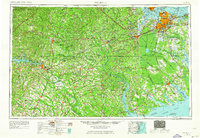
Dismal Swamp dominates the central landscape of this mid-century survey, a wilderness interior bounded by the expanding urban footprints of Norfolk, Portsmouth, and Suffolk. The map reveals a region heavily defined by its transition from the deep woods and peat bogs surrounding Lake Drummond to the bustling maritime gateways of Chesapeake Bay. The industrial and military significance of Hampton Roads is evident in the dense concentration of naval installations and the spiderweb of rail lines like the Seaboard Air Line RR and Norfolk Southern RY converging on the coast.
Find a feature on this map
276 named features on this map. Tap any name to fly to it.
Don’t see what you’re looking for? This feature index may not catch every label — zoom into the map to look around manually.
Map Details
Editions of this 1953 Norfolk Map
4 editions found
Other maps of this area

1891 · Farmville
USGS Topo · 1:125,000

1893 · Farmville
USGS Topo · 1:125,000

1893 · Virginia Beach
USGS Topo · 1:125,000

1894 · Petersburg
USGS Topo · 1:62,500

1897 · Amelia
USGS Topo · 1:125,000

1901 · Parmele
USGS Topo · 1:62,500

1901 · Williamston
USGS Topo · 1:62,500

1902 · Williamston
USGS Topo · 1:62,500

1902 · Parmele
USGS Topo · 1:62,500

1902 · Rocky Mount
USGS Topo · 1:62,500